Trailhead for Angels Landing. Hike is 2.4 miles each way and you walk uphill the entire way to the top. The peak of Angels Landing is 1,208 ft. (about 1/4 mile) above the canyon floor at an elevation of 5,785 ft.

Up the first series of switchbacks...the easy series...
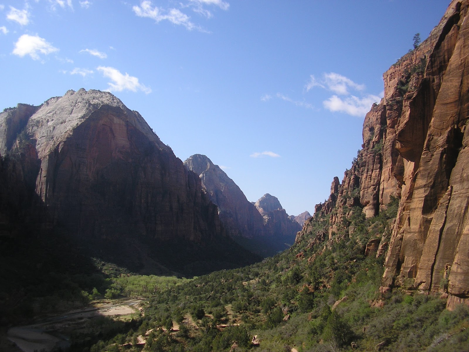

At the top of the first series of switchback.

The final 1/2 mile ascent from Scout Lookout.

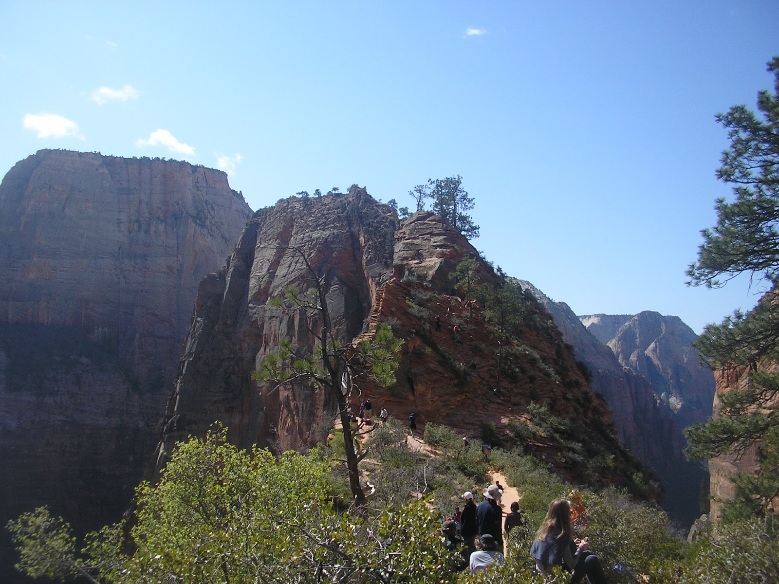
Ominous sign before the final climb.


Steep drop on final climb.

Red flowers dispersed across the park.

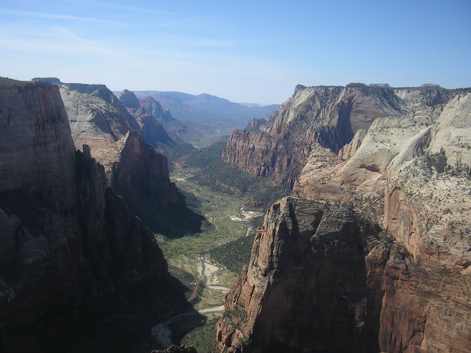
Zion Canyon (to the south) from top of Angels Landing.

Great White Throne to the east (6,744 ft.)

Towards Temple of Sinawava and the Narrows to the west.

Zion Canyon. The Zion Lodge is mid-way down the canyon.

Cable Mountain on the right and Observation Point on the left

At the top of Angels Landing.


Canyon between Walter's Wiggles (the 2nd series of 21 switchbacks) and the 1st series on the way back down.

Angels Landing.

Observation Point.

South towards the Lodge.

Heading down Kayenta Trail and Emerald Pool Trails. About 3 miles total.

Looking east from Emerald Pools.

Emerald Pools.


The Watchman (6,545 ft.) hovering above the campground.

Photos from the 3.5 mile Pa'rus Trail.


Slot Canyon on 8-mile Observation Point Trail. This is early into the hike that gains 2,148 ft. in elevation, essential 1/2 mile.

Cable Mountain.


...and to the south.

View from Observation Point: Zion Canyon, including Angels Landing on the bottom right.

Angels Landing.

Cable Mountain.

Pictures from the hike down.


Weeping Rock and its natural spring.


The Narrows. You can reach the southern tip of the Narrows after completing the first leg of the 2.2-mile hike. From here, you walk in ice cold water up to your knees. We only went about 1/4 mile down this stretch.


The Pulpit and the Temple of Sinawava.

Court of the Patriarchs (from left to right; Abraham, Isaac, and Jacob, which is blocked by Moroni on the far right).


West Temple on the left, the highest point in Zion (7,810). The Altar of Sacrifice is on the right with the red, iron-stained streaks.

Sunset along the 2.7-mile Watchman Trail.


Bryce Canyon from Sunrise Point (8,017 ft.)

Various shots of pink hoodoos from 2-mile Queens Garden Loop. Hoodoo comes from a word meaning "to cast a spell."

Thor's Hammer somewhere in the distance.


Queen Victoria!


The Colorado River near Page, Arizona.


No comments:
Post a Comment